Mazatlán lies along the Pacific Mexican coast, just below the Tropic of cancer. Thus, it marks the beginning of the Mexican tropics. Its perpetual summer-like climate has become home to a growing number of international travelers seeking escape from the winter cold.
Mazatlán’s beauty is well known. With its swaying palms and miles of sun-drenched golden sand beaches, beckoning islands and blue lagoons, it has certainly earned its title as the “Pearl of the Pacific”.
Despite its popularity as a tourist destination, it owes its existence to the local industry. It is a leading manufacturing center for the state of Sinaloa, as well as homeport to a large commercial and sportfishing industry. So, as the tourists relax on the beaches in front of their hotels in the Zona Dorada, Mazatlán has a life of its own in the old town at the tip of the peninsula. In the churches, markets, shady plazas, and traditional neighborhoods, people carry out their daily lives.
Orientation
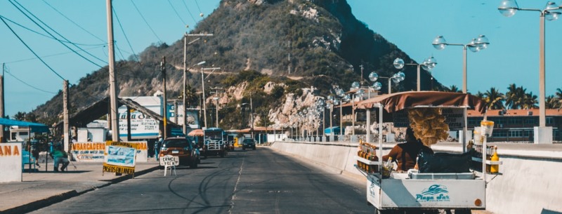
As the city’s main artery winds its way north for 15 miles, it changes names five times but never strays far from shore. Beginning below the rocky perch of El Faro (the lighthouse) on the tip of the Mazatlán peninsula, the Malecón (seawall) boulevard passes by the old hotels and cafes of the Olas Altas (High Waves) neighborhood. Next, it winds past a succession of rocky points and beaches and continues through the flashy Zona Dorada (Golden Zone) beach hotels and restaurants. Then the boulevard slips inland briefly, curves around a marina, and then back to the beach. As it continues on past grassy dunes and groves, the hotels thin out until it reaches a sheltered cove beneath Punta Cerritos hill.
Climate
One reason Mazatlán is so popular is its near-perfect climate. Situated just south of the Tropic of Cancer, it enjoys warm weather year-round. Pacific Ocean breezes buffer the coastline from the hot, dry air coming off the Sonoran Desert. Air temperatures average 19.4°C (67°F) in Jan., 27.2°C (81°F) in July, while water temperatures along with the beach range from 20°C (68°F) to 24°C (76°F).
The rainy season runs from June-Oct. From July-Sep, frequent rain and summer temperatures combine to produce warm and muggy afternoons, but its not that bad.
When To Go
From August to mid-October is the low season when room prices drop to their lowest, so some budget-minded travelers make a point to visit during this time of year. Many Mexicans like to take a vacation during the summer months. July is Mazatlán’s busiest month for tourism, and December is the second busiest when many foreign tourists flock in. These two months is the only time of year when reservations are necessary, except for during Carnival (late February or early March).
At any rate, in Mazatlán the local population always far exceeds the tourist population, so you always have plenty of opportunities to interact with the locals and not be overrun with tourists.
Downtown Mazatlán
Pointing the way to the center of old Mazatlán are the towers of the Catedral Basílica de la Purísima Concepción. Begun is 1856 by the Bishop Pedro Loza y Pardave, the cathedral was built on the site of an original Indian temple. However, due to Mazatlán’s somewhat turbulent history, it was not completed until 1899 and finally then elevated to the status of basilica in 1937.
Inside, the image of the city’s patron saint, the Virgen de la Purísima Concepción (Virgin of the Immaculate Conception) looms over the gilded, baroque main altar. Overhead are soaring domes and pointed arches, while the ever-present Virgen de Guadalupe waits for you on the left as you exit. Open daily 6 a.m. to 1 p.m. and 4-8 p.m.
In front of the cathedral is the Plaza de la Republica, with its lush tropical foliage and traditional wrought-iron Porfirian kiosko (bandstand). Just to the right is the Palacio Municipal (city hall). From here is where the Presidente municipal (county mayor), on the eve before Independence Day, 16 September, shouts out the traditional Grito de Dolores.
Just two blocks behind the cathedral, wander around the Mercado Central (central market). Take in the sights and smells, pick up a bag of candy or some fresh fruit, and then head down Juárez to Constitución. Turning right, go one block to Plazuela Machado, Mazatlán’s original central plaza. The plaza was named in honor of Juan Nepomuceno, a founding father who donated the land. At the west end of the plaza, along Calle Heriberto Frías, are the Portales de Cannobio, the arcade of the old estate house of apple grower Luis Cannobio, a 19th-century Italian resident. Among the Porfirian style buildings and monuments that cluster along the streets surrounding the plaza is the Teatro Angela Peralta. The theater was completed around 1890 and later dedicated to Angela Peralta.
Olas Altas
A few blocks west from Plazuela Machado along Calle Sixto Osuna is the small Museo Arqueologia at Sixto Osuna 76. Its well-organized exhibits outline Sinaloan prehistory and culture. You will see many petroglyphs, human and animal figurines, and ancient polychrome pottery of Sinaloa. open Tues.-Sun. 10 a.m.-1 p.m. and 4-7 p.m., Tel. (69) 85-3502. Across the street, you can peek into the restored Casa de la Cultura. Its offerings vary from art exhibits and literary readings to musical and dramatic performances.
From here, continue west a few blocks to the malecón and Av. Olas Altas. Stretching for several shorefront blocks, this cafe-lined boulevard and the adjacent Olas Altas beach was once the tourist zone of Mazatlán. At the south end, in front of the 1889 school building at the base of Cerro Vigia are the Escudos de Sinaloa y Mazatlán (City and State Shields of Sinaloa and Mazatlán). At the north end is the Monumento al Venado (Monument to the Deer).
Cerro Vigia
When pirates lurked in these parts, colonial soldiers protected against them by maintaining a 200-year long vigil scanning the horizon from atop Cerro Vigia. To enjoy a sweeping view of the entire city, head up to the Pergola de Cerro Vigia viewpoint at the top. Unless you are up for some exercise, to get there you might want to catch a pulmonia (open air taxi) up Paseo Centenario, the extension of Av. Olas Altas. Just below the plaza is the little known Cafe El Mirador offering refreshments and a view. Open daily 12-9 p.m.
Cerro Creston and El Faro
A little further to the south rises Cerro Creston, which is topped by El Faro (the lighthouse). Its 515-foot elevation qualifies it as the world’s highest natural lighthouse. Along the jetty that connects Cerro Creston to the mainland, are the docks and anchored flotas deportivas (sportfishing fleets) that take the anglers out in search of Marlin and Sailfish.
You can hike up for a closer look at El Faro if you like. Be sure to bring a hat, some insect repellent, and something to eat for a picnic at the summit. The trail begins at the base of the hill, at the end of the pavement past the docks. The path starts out wide but narrows about halfway up. As it nears the top, you pass by rocky outcroppings until you come to the fence that surrounds the lighthouse. If you are lucky, the keeper might let you in for a look around and to sign his book. If you arrive at dusk you can see the beacon in action, but be sure to carry a flashlight. The 1.5 million watt beacon sends out rotating beams of light focused by the antique Fresnel Lens atop the tower.
Paseo Claussen
Turning around and heading north, as you pass the Monumento al Venado, Av. Olas Altas becomes Paseo Claussen. It was so named for the wealthy German immigrant who financed this scenic drive to be blasted through. The drive hugs the shore as it curves around the foot of Cerro Neveria, which derives its name from the 1800s when its many tunnels served as storage for ice imported from San Francisco. The hilltop is now home to several radio and microwave antennas.
As you curve around the cerro, you first come to the beautiful, and nearly erotic Monumento Mujer Mazalteca. Nearby is the Caverna del Diablo (Devil’s Cave). Now closed off by heavy bars, it once served as the escape route for soldiers guarding ammunition stores n caves farther up the hill.
A short distance ahead is the Punta de Clavadistas (Diver’s Point), with its 4 story diving platform towering above the tide pools below. The divers are professionals and take their work very seriously. At low tide, they must time their dives precisely to coincide with large swells coming in. They perform several times daily, more frequently on Sundays and holidays.
Heading further North, you find the Continuity of Life sculpture, popular with the locals in the evenings when they come to watch its colored fountains. Just a block beyond that is the Fuerte 31 de Marzo (31st of March Fort). It is named in honor of the heroic stand taken by the local garrison that repelled a French invasion on the 31st of March 1864.
Punta Camerón and The Offshore Islands
Gently curving North from downtown is the ribbon of sand known a Playa Norte, until it passes Punta Camerón. Offshore from Punta Camerón lie Mazatlán’s three islands Venados (Deer) the nearest, Chivos (Rams), and Pajaros (Birds) furthest from shore. As the shoreline works its way north through the cluster of Zona Dorada hotels, it becomes Playa Gaviotas.
Luxury Accommodations
Marina El Cid
This recent addition to the El Cid family has 210 luxury rooms and suites next to a 90 slip marina, well-kept grounds that surround two pools. Guests have access to all the El Cid Mega Resort facilities listed above, and they have a shuttle service to get you there. Rates run about USD $150 to $300. Located at Calz. Camarón Sábalo, Tel. (69) 13-1333.
Camino Real
Mazatlán’s top hotel sits in its own private cove, all 126 spacious rooms and suites come with ocean views. Nicely landscaped grounds, a pool, tennis courts, open-air lobby. Rates run about USD $80 to $150. Located on Punta Del Sábalo, Tel. (69) 13-1111.
Los Sabalos Resort
Clean but simple suites, some reports say overpriced. Popular with the package groups. Several bars and restaurants, pool, gym, spa, tobacco shop, etc. Rates run about USD $85-$300. Located at R.T. Loaiza 100, Tel. (69) 83-5333.
Royal Villas Resort
Spacious and well-appointed one and two-bedroom suites with kitchens, balconies and ocean views. Freeform pool, health club, and game room. Rates run about USD $130-$400. Located at Calz. Camarón Sábalo 500, Tel. (69) 16-6161.
Hotel Pueblo Bonito
With a reputation as one of the best run and most popular luxury resorts on the beach, with suites that all come with ocean views, kitchenettes, balconies, and separate sitting areas. 3 restaurants, 2 large pools, lush landscaping, live flamingos, garden jacuzzi, and a gym. Rates run about USD $160-$190. Located just south of the Camino Real, at Playa Sábalo 2121, Tel (69) 14-3700.