In 1921, U.S. Forest Service planner Benton MacKaye wrote a magazine article suggesting a trail be established to connect Mount Washington in New Hampshire to Mount Mitchell in North Carolina. As a result, in 1925, the Appalachian Trail Conference chose the exact path, flagged the path and built various sections including shelters, bridges, and steps. They even wrote guidebooks to aid the hiker and backpacker. In 1968, Congress passed the National Trails System Act, making the A.T. and the Pacific Crest Trail the first National Scenic Trails. Today the trail extends from Mount Katahdin, Maine to Springer Mountain, Georgia.
Attractions
Traveling from south to north, the white-blazed Appalachian Trail enters North Carolina in the Nantahala National Forest climbing to Yellow Mountain, 4,000 feet. At Yellow Mountain, the trail turns south and travels almost to the Georgia state line before turning north again. It turns north along the Tennessee Valley Divide heading to Waslik Poplar scenic point. It continues in a slight northwestern direction passing Buck Knob, Rattlesnake Knob, Sheep Knob, and Siler Bald before turning due west to Fire Gap Ridge. Turning eastbound it touches Wayah Gap moving in a northern direction to Wine Spring Bald at which point it heads east to Wayah Bald. From here the trail travels straight north to Copper Ridge Bald, Wesser Bald at 4,000 feet and to the Nantahala River dropping a couple of thousand feet. The trail turns westward for about 6 miles before turning north. On this western route, it passes Cheoah Bald which is an ascension of about 1,000 feet. Back on the northern route, it passes Steph Gap, 3,000 feet. After crossing SR 143 the Appalachian Trail heads northwest again along the Cheoah Mountains before reaching the Yellow Creek Mountains.
The trail remains at approximately 3,000 feet until it reaches Fontana Dam and Lake, which are part of the Great Smoky Mountains recreation opportunities, 2,000 feet. There is fishing, swimming, and lodging. From this point, the trail travels due north to Shuckstack Lookout and Greer Knob. Just beyond Greer Knob, the trail follows the North Carolina and Tennessee state lines traveling in an easterly direction.
It follows the state line, passing Devils Tater Patch, McCambell Knob, Thunderhead Mountain, Brier Knob, Mount Davis, Cold Spring Knob and Clingman’s Dome, elevation 5,000 feet. At Clingman’s Dome, the highest peak in the Smokeys and the second highest in the East, the main ridge is slender as it travels through a forest of evergreen spruce and fir forest. Many of the trees are similar to those found in Canadian forests. The trail heads northeast to Mount Collins, Newfound Gap at approximately 5,000 feet, Mount Kephart, Horseshoe Mountain, and Laurel Top.
At Laurel Top, elevation around 4,000 feet, the trail dips south crossing Enloe Creek before traveling northeast to Mount Sequoyah, Mount Chapman, and Mount Guyot. Snake Den Mountain is the next area with elevations at 5,000 feet. At Cosby Knob, back down to 4,000 feet, the trail heads north again to Sunup Knob then to Mount Cammerer where it turns east again until it reaches SR 32 just before the little town on Waterville. Just beyond SR 32, the trail heads north for about 1 mile then travel east again along the Tennessee and North Carolina state lines. The trail travels to Max Patch Mountain scenic area then travels north to Lemon Gap, Bluff Mountain, Big Rock Spring, and Cane Brake Ridge. About 2 miles beyond Cane Brake is the town of Hot Springs. There are overnight lodging and restaurants available.
The trail parallels SR 209 a mile or so before heading east to Lover’s Leap. The path travels north to Mill Ridge, up to Rich Mountain, Buzzard Roost Ridge then crossing SRs 79 and 208. At this point, the trail moves in a northeastern direction onto Bald Mountains still on the Tennessee and North Carolina state lines.
The Cherokee National Forest is to the north and the Pisgah National Forest is to the south. Southbound, the trail descends to 3,000 feet before ascending to 4,000 feet where it turns east at Big Flat. The ridge is still along the Bald Mountain Range and remains on that range passing Big Bald and Little Bald. At US 19W / SR 36, the trail heads north of the Pisgah National Forest land property and into the Cherokee National Forest in Tennessee at which point it travels on up to Damascus, Virginia.
Recreation
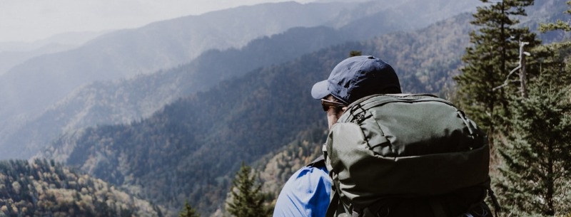
The Blue Ridge Parkway, State Parks, Pisgah, and Nantahala National Forests and all of their amenities, including trout fishing, camping, picnicking, wildlife viewing, overlooks and more are major features along the Appalachian Trail.
Climate
North Carolina generally has mild winters and warm summers. The mountainous area where most of the Appalachian Trail lies, experiences dramatic extremes, particularly at higher elevations. Winter daytime temperatures range around 36 degrees Fahrenheit (2 Celsius) at lower elevations. Summer daytime temperatures range below 76 degrees Fahrenheit (24 Celsius). The state has a fairly wet climate with an average precipitation for this area averaging 44 to more than 52 inches (112 to more than 132 centimeters). Caution should be taken when traveling to the Appalachian Trail. Temperatures can be extreme with unpredictable sudden thunderstorms. Layered clothing and rain gear is strongly advised.
Location
The Appalachian Trail travels along the western mountainous area of North Carolina, many of the miles are on the North Carolina and Tennessee state lines. There are over 500 access points. Many are located along the Blue Ridge Parkway, Great Smoky National Park and the Pisgah and Nantahala National Forests. Overnight parking is available throughout these areas. The northern Roan Mountain area offers views of the beautiful rhododendron gardens while the Pisgah area provides spectacular scenery of the southern Appalachians. Farther south in the Great Smoky Mountains, the path becomes quite difficult when traveling the Stecoah-Cheoah Mountain Area. Southwestern North Carolina which is the Nantahala National Forest area, gives way to 4,000-foot gaps and 5,000-foot peaks.